About All Tours From Koh Samui ToursBoat ToursFrom Koh Phangan ToursSnorkeling ToursSpeedboat Tours Directions Hours & Fees Guides
Find Tours 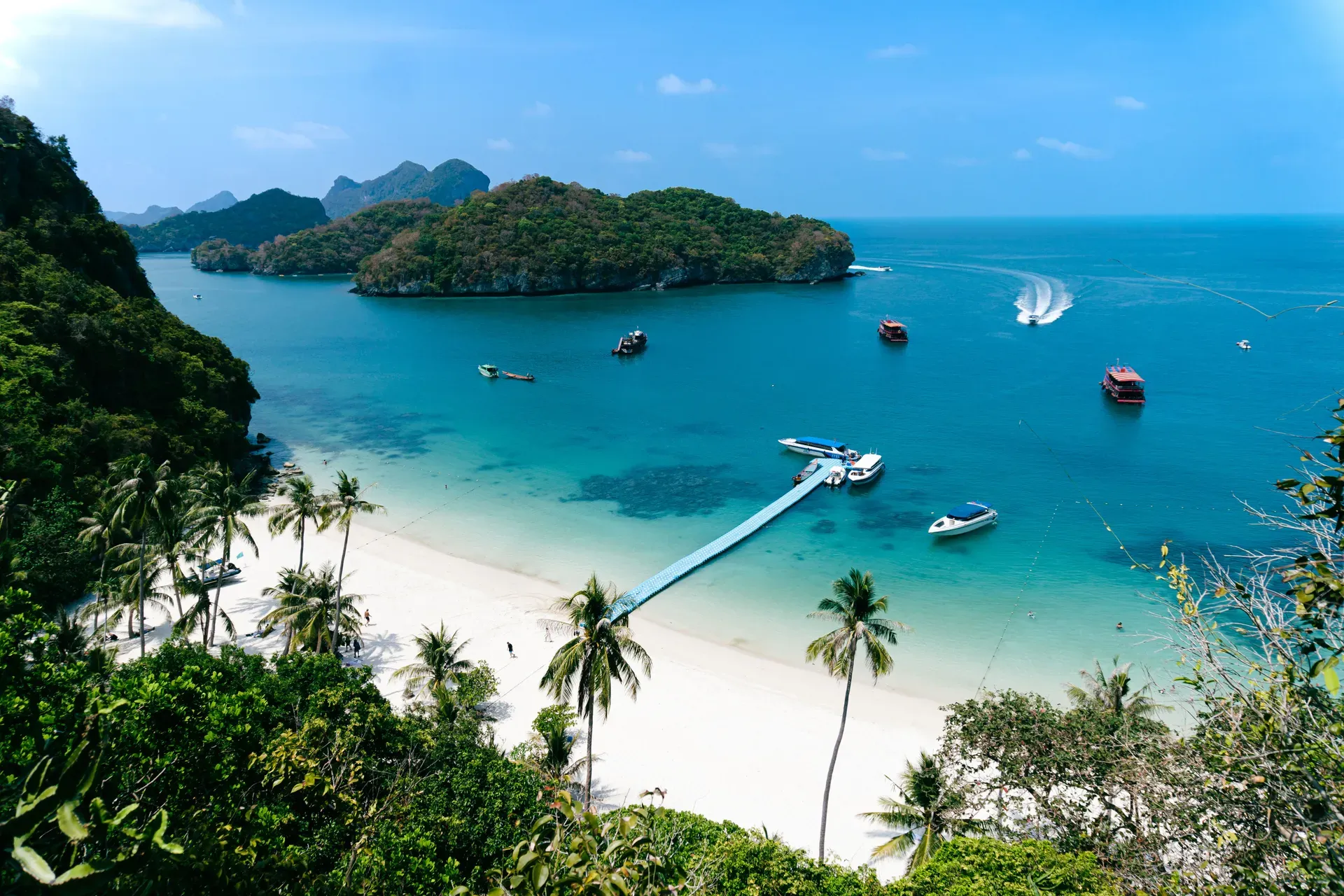
Ang Thong National Marine Park covers 102 square kilometers of the Gulf of Thailand, comprising 42 limestone islands east of Ko Samui. The protected archipelago contains steep karst cliffs, inland saltwater lagoons, and shallow coral reefs.
Ang Thong National Marine Park is an archipelago of 42 limestone islands in the Gulf of Thailand. The protected area spans 102 square kilometers, though land makes up less than a fifth of that footprint. Jungle-topped karst columns rise straight out of the shallow, sediment-tinged water. Most visitors arrive on day trips from Ko Samui or Ko Pha Ngan, spending their time kayaking between the sheer cliffs or climbing the steep trails of Ko Wua Ta Lap.
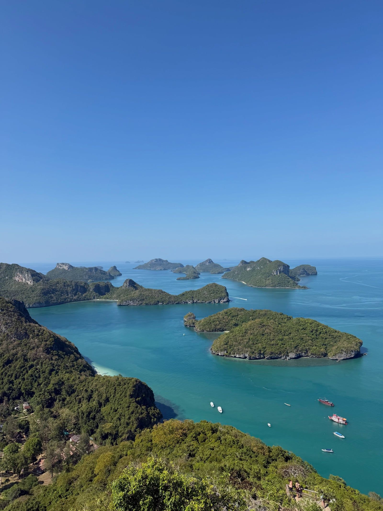
The park headquarters sits on Ko Wua Ta Lap, alongside a ranger station, a single restaurant, and a small campground. This island is the primary staging ground for the 500-meter hike to the archipelago's main viewpoint. The trail gains almost 400 meters in elevation over jagged limestone. You pull yourself up using ropes tied to trees. The heat is intense, and the sharp rocks destroy cheap footwear. Wear actual hiking shoes.
Below the surface, the water averages just 10 meters deep. Silt from the nearby Tapi River limits visibility, but the northern islands still support shallow coral gardens frequented by green sea turtles. January through April brings the calmest seas and clearest water. Don't plan a trip in November. The park shuts down entirely for six weeks during the monsoon season when strong winds make the 30-kilometer boat crossing dangerous. Check the official Department of National Parks website for the exact December reopening date before booking a flight.
The Thai government officially designated Mu Ko Ang Thong as a national marine park on 12 November 1980. This made it one of Thailand's earliest marine protected areas, placing 102 square kilometers of the Gulf of Thailand under the jurisdiction of the Department of National Parks, Wildlife and Plant Conservation. Before this designation, the 42 islands saw minimal human habitation. Small, transient fishing communities occasionally used the sheltered coves during monsoon storms, but the steep limestone topography prevented large-scale agricultural settlement. Today, permanent communities exist only on Ko Wua Ta Lap and Ko Phaluai.
The park gained global environmental recognition on 14 August 2002. The Ramsar Convention registered Ang Thong as Wetland of International Importance site number 1184. This status acknowledged the ecological value of its shallow marine waters, karst sinkholes, and endemic species like the Ang Thong Lady's Slipper Orchid. Conservation efforts intensified following this designation. Park rangers began enforcing strict bans on single-use plastics and chemical sunscreens containing oxybenzone. They also implemented an annual closure period—typically from early November to mid-December—to allow the marine ecosystem to recover without boat traffic.
Ang Thong's international profile exploded in the late 1990s. British author Alex Garland used the archipelago's isolated, lagoon-hidden geography as the primary inspiration for his 1996 novel The Beach. The book drove a massive surge in backpacker interest across the Gulf of Thailand. When 20th Century Fox adapted the novel into a film in 2000, production actually bypassed Ang Thong. The crew filmed the famous beach scenes on the Phi Phi Islands in Krabi Province and the waterfall jump at Haew Suwat in Khao Yai National Park. Despite this geographical shift, tourists continue to associate Ang Thong with the story. The resulting influx of day-trippers pushed the park to cap daily boat entries. Book a private charter if you want to avoid the midday crowds at the main anchorages.
Steep limestone karst formations dominate the 42 islands of Ang Thong. These jagged cliffs formed from the accumulation of marine organisms millions of years ago, later pushed upward by tectonic activity and carved by acidic rainfall. The highest peak reaches 396 meters above sea level on Ko Phaluai. The porous limestone supports extensive cave systems and sinkholes across the archipelago. Bua Bok Cave, located a kilometer from the Ko Wua Ta Lap headquarters, contains massive stalagmites and flowstone deposits resembling lotus flowers. The hike there requires scrambling over sharp rocks.
The most famous geological formation is Thale Nai, a saltwater lake on Ko Mae Ko. Often called the Emerald Lagoon, this jade-green body of water sits inside a collapsed karst sinkhole. Sheer limestone walls ring the lake completely. Thale Nai connects to the surrounding Gulf of Thailand through a network of underwater caves, allowing the water level to rise and fall with the ocean tides. You reach the viewing platform via a 20-minute climb up a series of metal and wooden stairs built into the cliffside. Swimming in the lagoon is strictly prohibited to protect its delicate chemical balance.
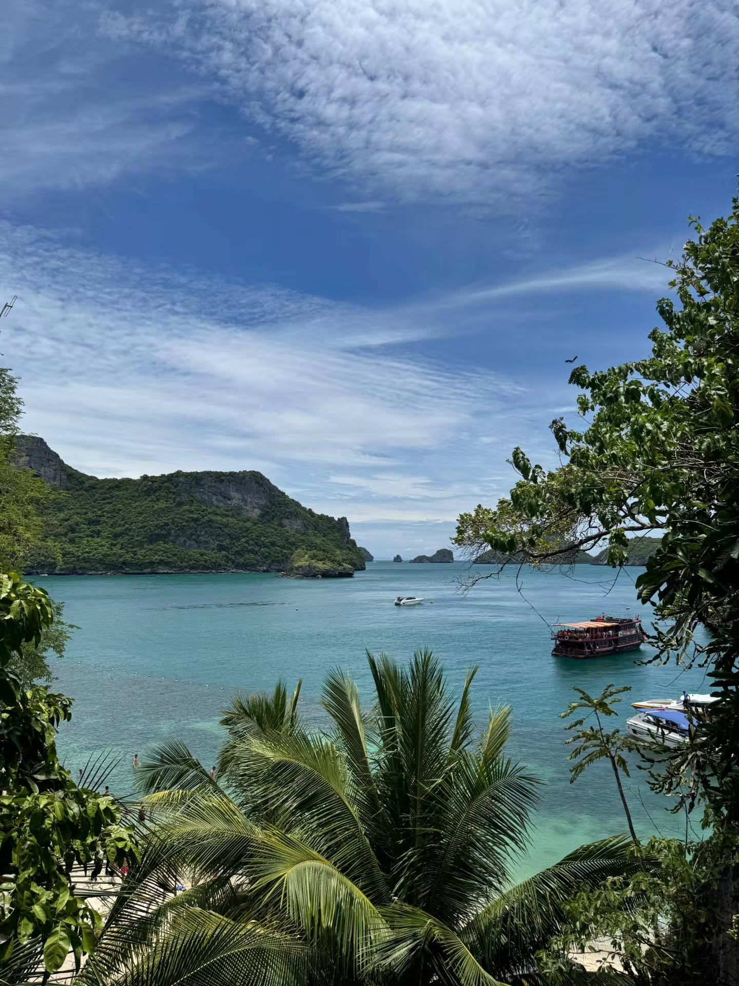
The marine environment surrounding these islands is unusually shallow. The water averages just 10 meters deep across the park. This shallow depth, combined with sediment runoff from the Tapi River on the mainland, limits underwater visibility compared to the deeper Andaman Sea. The northern islands hold the healthiest coral gardens. Kayaking provides the best way to examine the undercut cliffs at water level. Rent a double kayak and paddle through the narrow, sheltered channels between the karst towers. The water is calm enough for a five-year-old to ride along safely.
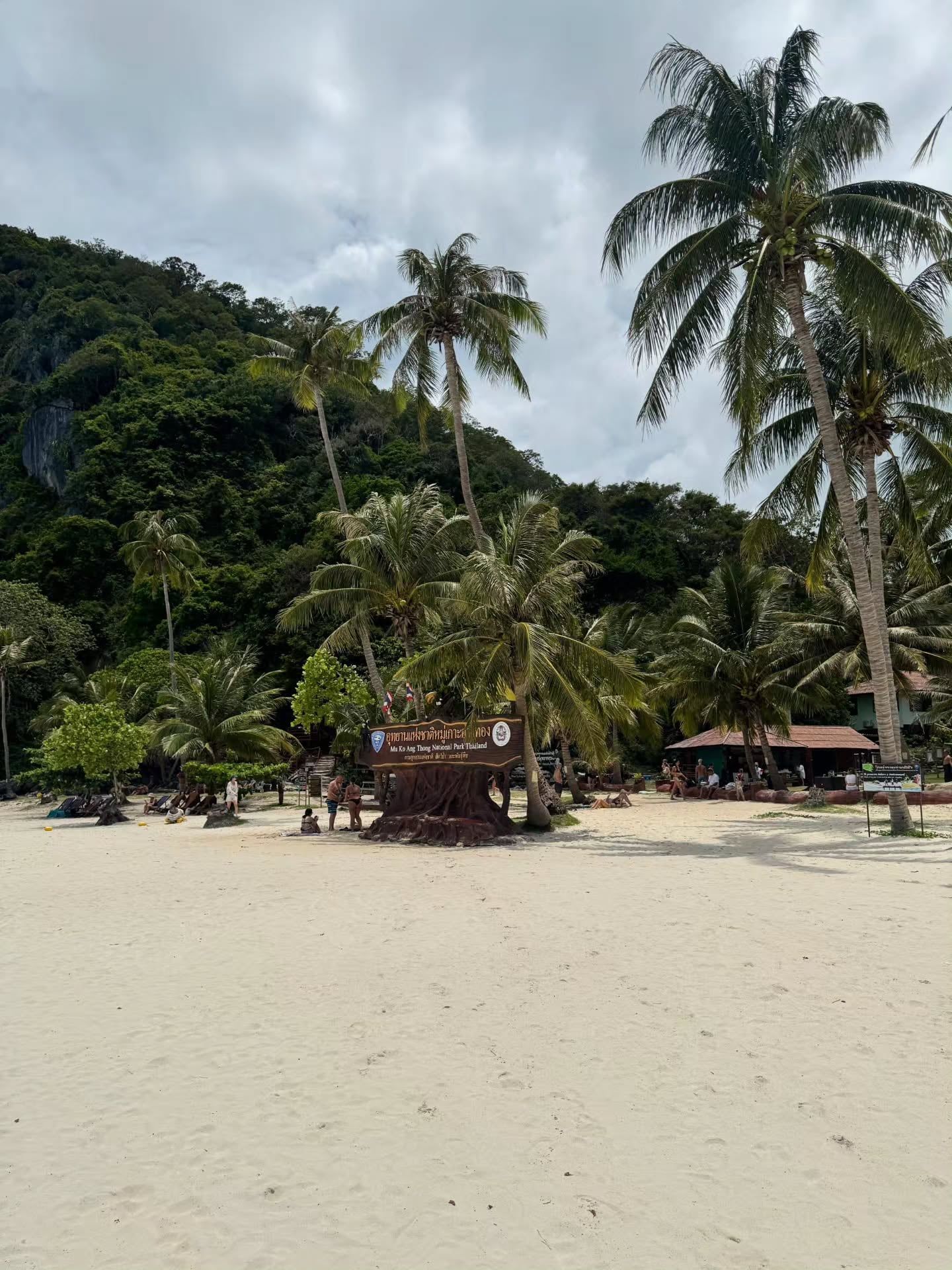
Ang Thong translates to "Bowl of Gold" in Thai. The name references the sheltered, resource-rich waters that historically provided safe harbor for local fishermen navigating the Gulf of Thailand. While the steep terrain prevented large-scale settlement, the islands provided temporary refuge during the heavy monsoon winds that batter the region every November. The small community on Ko Phaluai continues to practice traditional, small-scale fishing methods, operating under strict national park regulations that prohibit commercial trawling.
The archipelago holds a specific place in modern travel culture as the mythological ideal of the untouched Thai island. Alex Garland's fictionalized version of Ang Thong in The Beach created a template for backpacker escapism that defined Southeast Asian tourism for two decades. The narrative of a hidden, self-sustaining lagoon community directly mirrored the physical reality of Thale Nai on Ko Mae Ko. This literary connection transformed the park from a regional fishing ground into a global focal point for island-hopping travelers.
Today, the park functions as a strict conservation zone. The Thai Department of National Parks uses Ang Thong to test environmental policies before rolling them out nationwide. The strict enforcement of the drone ban carries fines up to 100,000 Baht. The complete annual shutdown from November to mid-December demonstrates a shift from prioritizing tourism to protecting the resident dusky leaf monkeys. Leave your drone at your hotel on Ko Samui.
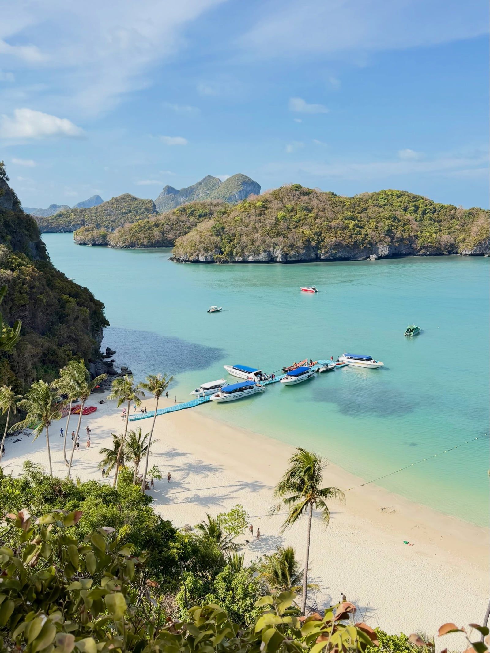
The famous beach scenes from the movie The Beach were not filmed in Ang Thong, despite the park inspiring the original novel.
The Ang Thong Lady's Slipper Orchid (Paphiopedilum angthong) is a rare plant species found nowhere else in the world.
Dusky leaf monkeys live in the jungle canopy near the Ko Wua Ta Lap ranger station and frequently forage along the shoreline.
Flying a drone without written permission from the Department of National Parks carries a fine of up to 100,000 Baht.
The water depth across the 102-square-kilometer marine park averages only 10 meters.
Visitors can sleep on the islands by renting a government-run tent for 450 Baht per night on Ko Wua Ta Lap.
The entire park shuts down to all visitors for roughly six weeks every November and December due to dangerous monsoon swells.
No. Access requires a licensed tour operator or private charter. There are no public ferries to the islands, so nearly all visitors arrive via organized day tours from Koh Samui, Koh Phangan, or Koh Tao.
The entrance fee is 300 Baht for foreign adults and 150 Baht for foreign children aged 3-14. This fee is almost always excluded from tour package prices and must be paid in cash directly to park rangers.
The park is open daily from 8:00 am to 5:00 pm. It closes entirely from November 1 to mid-December each year due to dangerous monsoon conditions.
A speedboat crossing from Koh Samui takes 45 to 60 minutes each way. A larger, slower tour boat covers the 30-kilometer distance in 90 to 120 minutes.
Yes. The 500-meter trail on Ko Wua Ta Lap gains 400 meters in elevation over jagged rocks. You will need to use ropes to pull yourself up, and proper closed-toe shoes are required.
Thale Nai is a saltwater lake on Ko Mae Ko surrounded entirely by sheer limestone cliffs. It connects to the ocean through underwater caves, and visitors view it from a platform reached by a 20-minute stair climb.
No, unless you have prior written permission from the Department of National Parks. Flying an unauthorized drone can result in confiscation of your equipment and fines up to 100,000 Baht.
Yes. The park operates a campground and basic bungalows on Ko Wua Ta Lap. Bungalows cost between 600 and 1,500 Baht per night, while camping costs 80 Baht per person.
January through April offers the calmest seas and clearest snorkeling visibility. Avoid October through mid-December, when rough seas cause frequent tour cancellations and the park eventually closes.
Kayaking and swimming are safe for young children, and tour operators provide appropriately sized life jackets. The steep viewpoint hikes on Ko Wua Ta Lap are not recommended for kids.
Browse verified tours with free cancellation and instant confirmation.
Find Tours